

[LMD publishes] A new model to trace the history of water on the surface of Mars
How could water have accumulated and flowed across the surface of Mars in the past?
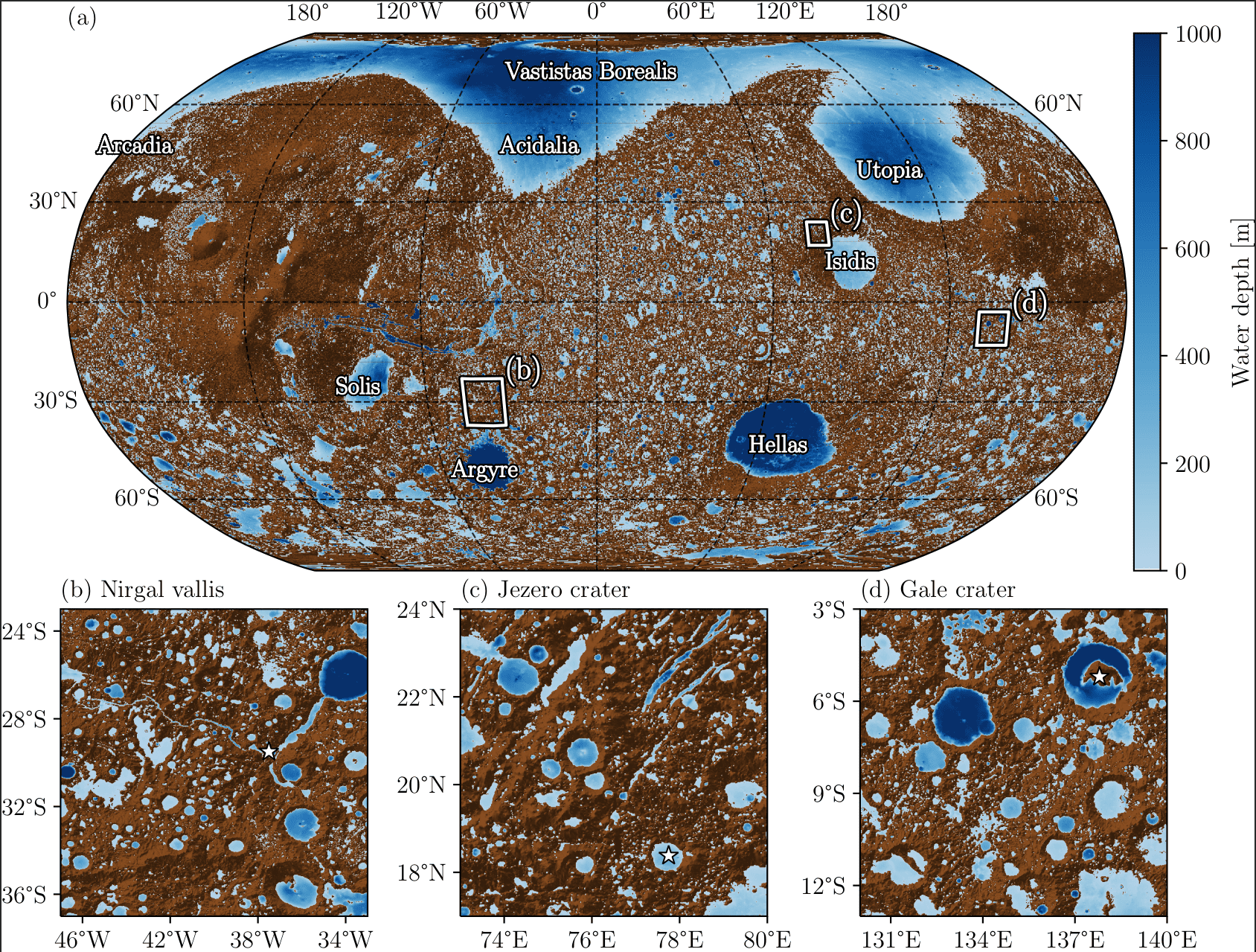
Researchers at the Laboratoire de Météorologie Dynamique (LMD) have developed a new high-resolution global hydrological model to investigate this question and reconstruct possible configurations of Martian lakes, seas, and oceans.
This work, led by Alexandre Gauvain, François Forget, Martin Turbet, Jean-Baptiste Clément, Lucas Lange, and Romain Vandemeulebrouck, has been published in Geoscientific Model Development (link below) and selected as a Highlight Paper, a distinction that recognizes research considered particularly noteworthy and likely to be of significant interest to the scientific community.
Simulating the Evolution of Surface Water
Observations of Mars reveal numerous traces of past liquid water activity, including valley networks, crater lakes, deltas, and possible ancient shorelines. These features point to a complex hydrological history, but how water was distributed and flowed across the planet’s surface remains a subject of debate.
To investigate this question, the researchers developed a high-resolution global hydrological model capable of dynamically simulating the formation, filling, merging, overflowing, and drying out of lakes and seas. The model relies on detailed Martian topography and allows bodies of water to evolve according to the amount of available water, without prescribing shoreline locations in advance.
An Ocean in the Northern Lowlands?
The researchers carried out several dozen simulations, varying in particular the total amount of water present on the surface of Mars and the evaporation rate.
The results show how, as the amount of water increases, individual water bodies can gradually connect and form vast expanses of water in the lowlands of the Northern Hemisphere. The model therefore makes it possible to explore different scenarios that could have led to the formation of an ancient Martian ocean.
It also makes it possible to track the main flow paths and identify areas where water may have accumulated, providing a framework for comparing simulations with the geological features observed on the Martian surface today.
A Step Toward a Model of Ancient Martian Climate
Beyond reconstructing Martian aquatic landscapes, this new model represents an important step toward a better understanding of the interactions between climate, hydrology, and the evolution of the Martian surface.
In the longer term, it could be coupled with climate models to jointly investigate the evolution of the Martian climate and the redistribution of water across the planet’s surface. This work will contribute to a better understanding of Mars’s history and of the conditions that may have allowed liquid water to persist over extended periods in the past, potentially creating an environment favorable to habitability.